|
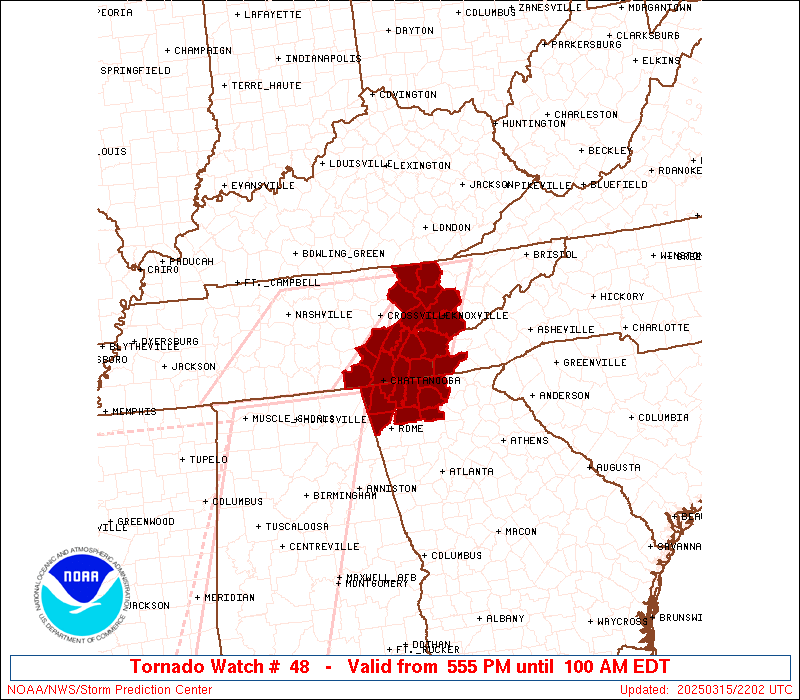
Initial List of Counties in SPC Tornado Watch 48 (WOU)
|
Back to Watch 48
|
 |
   WOUS64 KWNS 152155
   WOU8

   BULLETIN - IMMEDIATE BROADCAST REQUESTED
   TORNADO WATCH OUTLINE UPDATE FOR WT 48
   NWS STORM PREDICTION CENTER NORMAN OK
   555 PM EDT SAT MAR 15 2025

   TORNADO WATCH 48 IS IN EFFECT UNTIL 100 AM EDT FOR THE
    FOLLOWING LOCATIONS

   GAC047-055-083-111-123-129-213-227-295-313-160500-
   /O.NEW.KWNS.TO.A.0048.250315T2155Z-250316T0500Z/

   GA
   .    GEORGIA COUNTIES INCLUDED ARE

   CATOOSA              CHATTOOGA           DADE
   FANNIN               GILMER              GORDON
   MURRAY               PICKENS             WALKER
   WHITFIELD


   NCC039-160500-
   /O.NEW.KWNS.TO.A.0048.250315T2155Z-250316T0500Z/

   NC
   .    NORTH CAROLINA COUNTIES INCLUDED ARE

   CHEROKEE


   TNC001-007-009-011-013-065-093-105-107-115-121-123-129-139-143-
   145-151-153-160500-
   /O.NEW.KWNS.TO.A.0048.250315T2155Z-250316T0500Z/

   TN
   .    TENNESSEE COUNTIES INCLUDED ARE

   ANDERSON             BLEDSOE             BLOUNT
   BRADLEY              CAMPBELL            HAMILTON
   KNOX                 LOUDON              MARION
   MCMINN               MEIGS               MONROE
   MORGAN               POLK                RHEA
   ROANE                SCOTT               SEQUATCHIE


   ATTN...WFO...FFC...MRX...
|
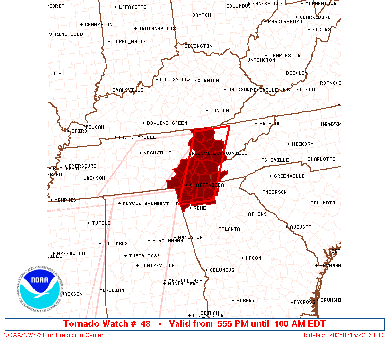
| Aviation Watch (SAW) for WW48 |
|---|
 |
| Note:
The Aviation Watch (SAW) product is an approximation to the watch area.
The actual watch is depicted by the shaded areas. |
   SAW8
   WW 48 TORNADO GA NC TN 152155Z - 160500Z
   AXIS..35 STATUTE MILES EAST AND WEST OF LINE..
   50N TYS/KNOXVILLE TN/ - 40SSE CHA/CHATTANOOGA TN/
   ..AVIATION COORDS.. 30NM E/W /30S LOZ - 30SSE GQO/
   HAIL SURFACE AND ALOFT..2 INCHES. WIND GUSTS..65 KNOTS.
   MAX TOPS TO 450. MEAN STORM MOTION VECTOR 25040.

   LAT...LON 36548337 34498432 34498555 36548463

   THIS IS AN APPROXIMATION TO THE WATCH AREA.  FOR A
   COMPLETE DEPICTION OF THE WATCH SEE WOUS64 KWNS
   FOR WOU8.
|
|


 @NWSSPC