|
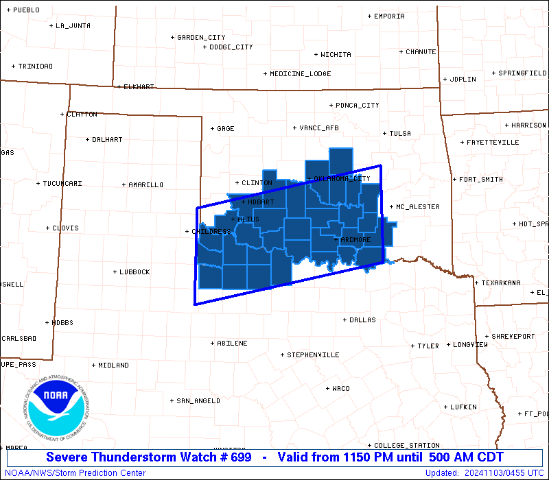
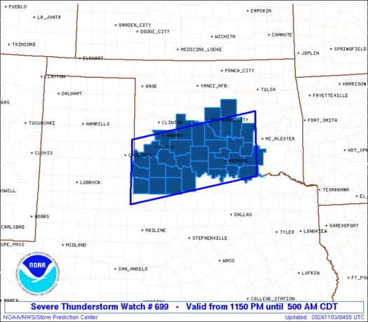
Initial List of Counties in SPC Severe Thunderstorm Watch 699 (WOU)
|
Back to Watch 699
|
 |
   WOUS64 KWNS 030445
   WOU9

   BULLETIN - IMMEDIATE BROADCAST REQUESTED
   SEVERE THUNDERSTORM WATCH OUTLINE UPDATE FOR WS 699
   NWS STORM PREDICTION CENTER NORMAN OK
   1150 PM CDT SAT NOV 2 2024

   SEVERE THUNDERSTORM WATCH 699 IS IN EFFECT UNTIL 500 AM CDT
   FOR THE FOLLOWING LOCATIONS

   OKC005-013-015-019-027-029-031-033-049-051-063-065-067-069-075-
   081-085-087-095-099-109-123-125-133-137-141-031000-
   /O.NEW.KWNS.SV.A.0699.241103T0450Z-241103T1000Z/

   OK
   .    OKLAHOMA COUNTIES INCLUDED ARE

   ATOKA                BRYAN               CADDO
   CARTER               CLEVELAND           COAL
   COMANCHE             COTTON              GARVIN
   GRADY                HUGHES              JACKSON
   JEFFERSON            JOHNSTON            KIOWA
   LINCOLN              LOVE                MARSHALL
   MCCLAIN              MURRAY              OKLAHOMA
   PONTOTOC             POTTAWATOMIE        SEMINOLE
   STEPHENS             TILLMAN


   TXC009-023-077-155-197-275-485-487-031000-
   /O.NEW.KWNS.SV.A.0699.241103T0450Z-241103T1000Z/

   TX
   .    TEXAS COUNTIES INCLUDED ARE

   ARCHER               BAYLOR              CLAY
   FOARD                HARDEMAN            KNOX
   WICHITA              WILBARGER


   ATTN...WFO...OUN...
|
| Aviation Watch (SAW) for WW699 |
|---|
 |
| Note:
The Aviation Watch (SAW) product is an approximation to the watch area.
The actual watch is depicted by the shaded areas. |
   SAW9
   WW 699 SEVERE TSTM OK TX 030450Z - 031000Z
   AXIS..60 STATUTE MILES NORTH AND SOUTH OF LINE..
   65SW LTS/ALTUS OK/ - 60NNE DUA/DURANT OK/
   ..AVIATION COORDS.. 50NM N/S /25SSE CDS - 12WSW MLC/
   HAIL SURFACE AND ALOFT..1 INCH. WIND GUSTS..60 KNOTS.
   MAX TOPS TO 450. MEAN STORM MOTION VECTOR 22030.

   LAT...LON 34840007 35629600 33889600 33110007

   THIS IS AN APPROXIMATION TO THE WATCH AREA.  FOR A
   COMPLETE DEPICTION OF THE WATCH SEE WOUS64 KWNS
   FOR WOU9.
|
|


 @NWSSPC