|
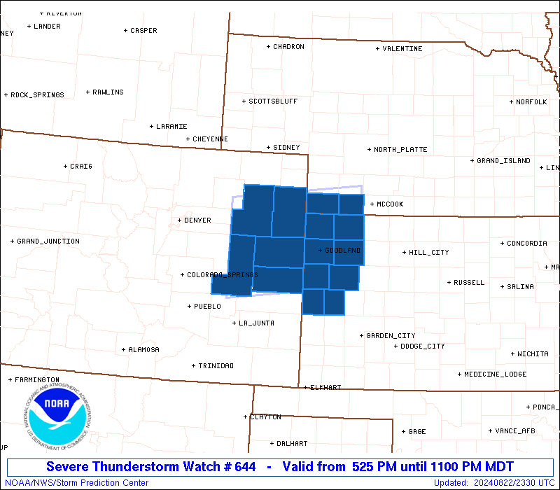
Initial List of Counties in SPC Severe Thunderstorm Watch 644 (WOU)
|
Back to Watch 644
|
 |
   WOUS64 KWNS 222322
   WOU4

   BULLETIN - IMMEDIATE BROADCAST REQUESTED
   SEVERE THUNDERSTORM WATCH OUTLINE UPDATE FOR WS 644
   NWS STORM PREDICTION CENTER NORMAN OK
   525 PM MDT THU AUG 22 2024

   SEVERE THUNDERSTORM WATCH 644 IS IN EFFECT UNTIL 1100 PM MDT
   FOR THE FOLLOWING LOCATIONS

   COC017-063-073-121-125-230500-
   /O.NEW.KWNS.SV.A.0644.240822T2325Z-240823T0500Z/

   CO
   .    COLORADO COUNTIES INCLUDED ARE

   CHEYENNE             KIT CARSON          LINCOLN
   WASHINGTON           YUMA


   KSC023-071-109-153-181-193-199-203-230500-
   /O.NEW.KWNS.SV.A.0644.240822T2325Z-240823T0500Z/

   KS
   .    KANSAS COUNTIES INCLUDED ARE

   CHEYENNE             GREELEY             LOGAN
   RAWLINS              SHERMAN             THOMAS
   WALLACE              WICHITA


   NEC057-087-230500-
   /O.NEW.KWNS.SV.A.0644.240822T2325Z-240823T0500Z/

   NE
   .    NEBRASKA COUNTIES INCLUDED ARE

   DUNDY                HITCHCOCK


   ATTN...WFO...GLD...BOU...
|
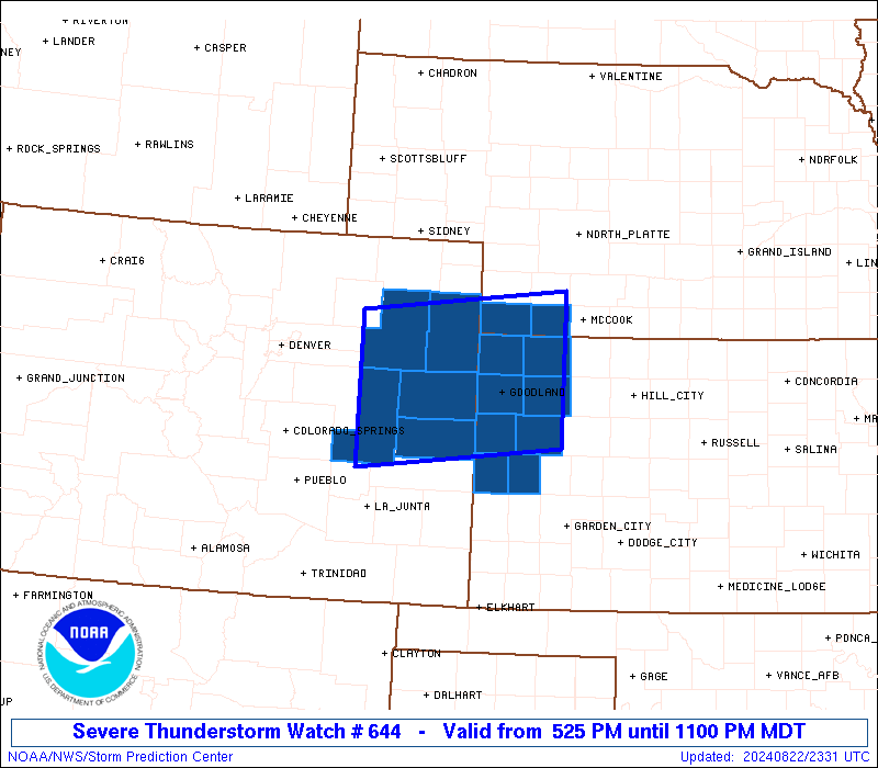
| Aviation Watch (SAW) for WW644 |
|---|
 |
| Note:
The Aviation Watch (SAW) product is an approximation to the watch area.
The actual watch is depicted by the shaded areas. |
   SAW4
   WW 644 SEVERE TSTM CO KS NE 222325Z - 230500Z
   AXIS..60 STATUTE MILES NORTH AND SOUTH OF LINE..
   5NNW LIC/LIMON CO/ - 50ENE GLD/GOODLAND KS/
   ..AVIATION COORDS.. 50NM N/S /53ESE DEN - 36SSW MCK/
   HAIL SURFACE AND ALOFT..2 INCHES. WIND GUSTS..65 KNOTS.
   MAX TOPS TO 500. MEAN STORM MOTION VECTOR 25025.

   LAT...LON 40210371 40500083 38770083 38470371

   THIS IS AN APPROXIMATION TO THE WATCH AREA.  FOR A
   COMPLETE DEPICTION OF THE WATCH SEE WOUS64 KWNS
   FOR WOU4.
|
|


 @NWSSPC