|
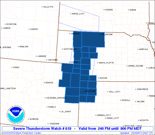
Initial List of Counties in SPC Severe Thunderstorm Watch 619 (WOU)
|
Back to Watch 619
|
 |
   WOUS64 KWNS 112039
   WOU9

   BULLETIN - IMMEDIATE BROADCAST REQUESTED
   SEVERE THUNDERSTORM WATCH OUTLINE UPDATE FOR WS 619
   NWS STORM PREDICTION CENTER NORMAN OK
   240 PM MDT SUN AUG 11 2024

   SEVERE THUNDERSTORM WATCH 619 IS IN EFFECT UNTIL 900 PM MDT
   FOR THE FOLLOWING LOCATIONS

   COC017-063-075-095-115-121-125-120300-
   /O.NEW.KWNS.SV.A.0619.240811T2040Z-240812T0300Z/

   CO
   .    COLORADO COUNTIES INCLUDED ARE

   CHEYENNE             KIT CARSON          LOGAN
   PHILLIPS             SEDGWICK            WASHINGTON
   YUMA


   KSC023-109-153-181-193-199-120300-
   /O.NEW.KWNS.SV.A.0619.240811T2040Z-240812T0300Z/

   KS
   .    KANSAS COUNTIES INCLUDED ARE

   CHEYENNE             LOGAN               RAWLINS
   SHERMAN              THOMAS              WALLACE


   NEC005-029-031-049-057-069-075-087-091-101-117-135-161-120300-
   /O.NEW.KWNS.SV.A.0619.240811T2040Z-240812T0300Z/

   NE
   .    NEBRASKA COUNTIES INCLUDED ARE

   ARTHUR               CHASE               CHERRY
   DEUEL                DUNDY               GARDEN
   GRANT                HITCHCOCK           HOOKER
   KEITH                MCPHERSON           PERKINS
   SHERIDAN


   ATTN...WFO...GLD...LBF...BOU...
|
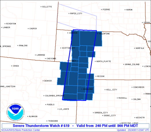
| Aviation Watch (SAW) for WW619 |
|---|
 |
| Note:
The Aviation Watch (SAW) product is an approximation to the watch area.
The actual watch is depicted by the shaded areas. |
   SAW9
   WW 619 SEVERE TSTM CO KS NE 112040Z - 120300Z
   AXIS..50 STATUTE MILES EAST AND WEST OF LINE..
   75NNW MHN/MULLEN NE/ - 40S ITR/BURLINGTON CO/
   ..AVIATION COORDS.. 45NM E/W /78WNW ANW - 34NE LAA/
   HAIL SURFACE AND ALOFT..2 INCHES. WIND GUSTS..60 KNOTS.
   MAX TOPS TO 500. MEAN STORM MOTION VECTOR 29025.

   LAT...LON 43050065 38660135 38660321 43050263

   THIS IS AN APPROXIMATION TO THE WATCH AREA.  FOR A
   COMPLETE DEPICTION OF THE WATCH SEE WOUS64 KWNS
   FOR WOU9.
|
|


