|
| Mesoscale Discussion 422 |
|
[an error occurred while processing this directive]
|
|
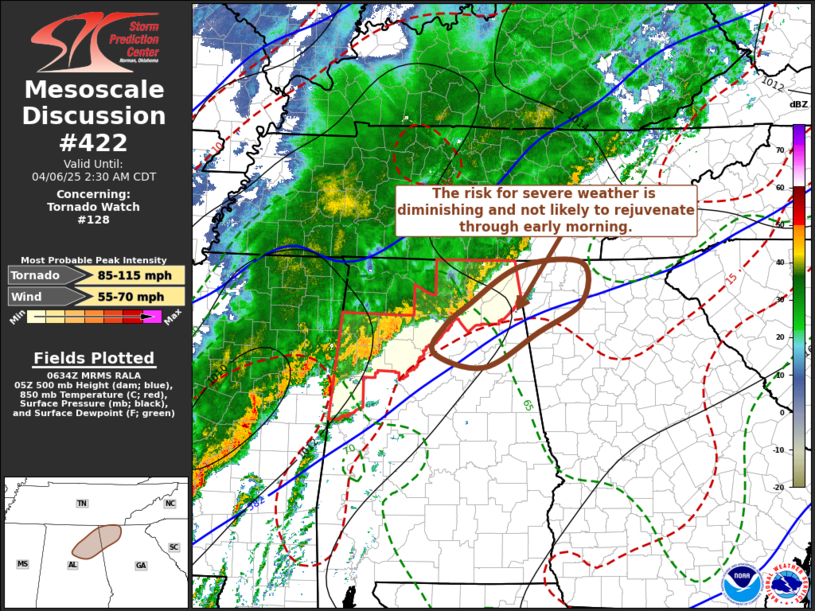
   Mesoscale Discussion 0422
   NWS Storm Prediction Center Norman OK
   0136 AM CDT Sun Apr 06 2025

   Areas affected...parts of nern AL...nwrn GA into adjacent sern TN

   Concerning...Tornado Watch 128...

   Valid 060636Z - 060730Z

   The severe weather threat for Tornado Watch 128 continues.

   SUMMARY...Ongoing convection approaching northwestern Georgia has
   shown substantive weakening trends, with little potential for
   appreciable intensification anticipated.  A new severe weather watch
   appears unlikely, but trends will continue to be monitored.

   DISCUSSION...Within a strong, and strongly sheared, ambient
   southwesterly regime, the leading edge of a line of convection
   continues to propagate toward areas near and south of the southern
   Appalachians.  Stronger convection is largely focused along and to
   the cool side of its outflow, and has recently tended to weaken,
   with lighting rapidly diminishing.  Relatively warm temperatures
   associated with broad ridging aloft continue to limit instability of
   southeasterly low-level storm inflow, and boundary-layer dew points
   decrease into the lower 60s across much of central and northern
   Georgia.  With little substantive improvement probable, ongoing
   convection seems likely to continue to weaken with diminishing
   severe weather potential across northeastern Alabama into adjacent
   northwestern Georgia.

   ..Kerr.. 04/06/2025

   ...Please see www.spc.noaa.gov for graphic product...

   ATTN...WFO...FFC...BMX...HUN...

   LAT...LON   34418632 34908552 34958460 34468459 34108524 33658606
               33838682 34178665 34418632

   MOST PROBABLE PEAK TORNADO INTENSITY...85-115 MPH
   MOST PROBABLE PEAK WIND GUST...55-70 MPH
|
|
Top/All Mesoscale Discussions/Forecast Products/Home
|
|


 @NWSSPC