|
| Mesoscale Discussion 186 |
|
[an error occurred while processing this directive]
|

|
   Mesoscale Discussion 0186
   NWS Storm Prediction Center Norman OK
   1114 PM CDT Fri Mar 14 2025

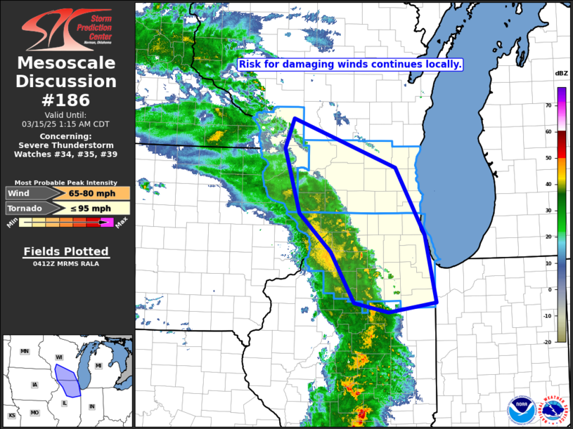
   Areas affected...southern Wisconsin into northern Illinois

   Concerning...Severe Thunderstorm Watch 34...35...39...

   Valid 150414Z - 150615Z

   The severe weather threat for Severe Thunderstorm Watch 34, 35, 39
   continues.

   SUMMARY...Strong/damaging gusts are expected to continue for the
   next couple of hours across southern Wisconsin and northern
   Illinois.

   DISCUSSION...Latest radar loop shows an arcing band of convection
   extending from southeastern Minnesota south-southeastward into
   Illinois.  Stronger cells along the leading edge of this band --
   advancing northeastward across southern Wisconsin and northern
   Illinois -- remain capable of producing damaging gusts in excess of
   60 MPH.  This convection will begin to affect the Milwaukee and
   Chicago metropolitan areas through/after midnight.

   ..Goss.. 03/15/2025

   ...Please see www.spc.noaa.gov for graphic product...

   ATTN...WFO...LOT...ILX...MKX...DVN...ARX...

   LAT...LON   42489037 43519069 43979050 43208834 42148773 41078749
               40928850 41078922 41878970 42489037
|
|
Top/All Mesoscale Discussions/Forecast Products/Home
|
|


