|
| Mesoscale Discussion 2128 |
|
< Previous MD Next MD >
|
|
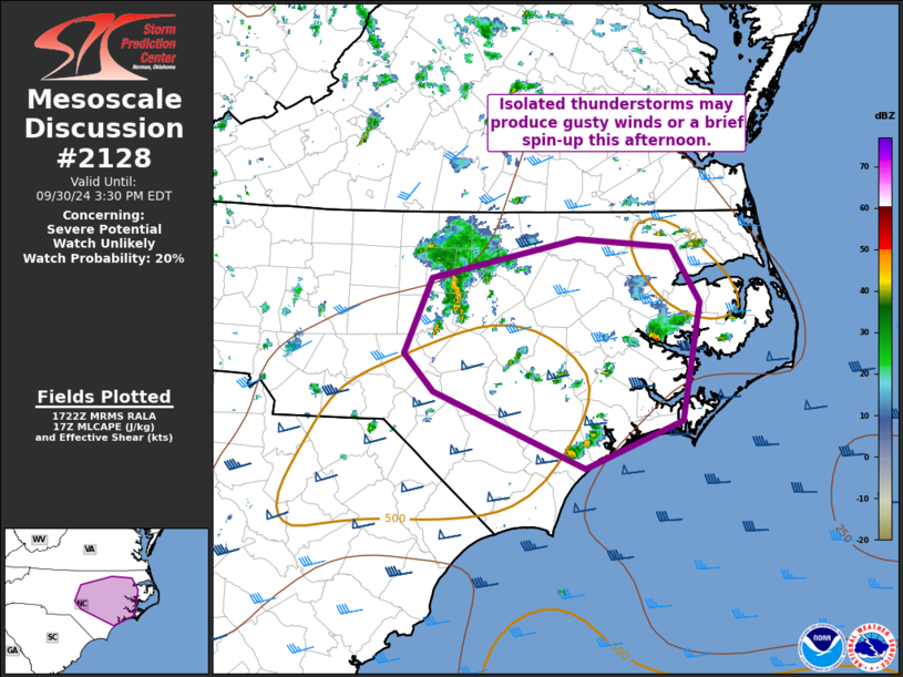
   Mesoscale Discussion 2128
   NWS Storm Prediction Center Norman OK
   1224 PM CDT Mon Sep 30 2024

   Areas affected...eastern North Carolina

   Concerning...Severe potential...Watch unlikely

   Valid 301724Z - 301930Z

   Probability of Watch Issuance...20 percent

   SUMMARY...Isolated thunderstorms are expected this afternoon into
   early evening across eastern North Carolina. This activity should
   mostly be sub-severe, but sporadic strong gusts 45-60 mph and
   perhaps a brief spin-up or two will be possible.

   DISCUSSION...Thunderstorms will increase in coverage over the next
   couple of hours in the vicinity of a surface boundary draped across
   eastern NC. Temperatures in the upper 70s to low 80s F amid
   dewpoints in the low 70s F are contributing to modest MLCAPE across
   the region. Poor midlevel lapse rates should largely limit updraft
   intensity. However, pockets of steeper low-level lapse rates and
   moderate vertical shear should allow for transient organized cells
   capable of producing gusty winds. Vertically veering low-level winds
   amid locally enhanced low-level shear in the vicinity of the surface
   boundary will be responsible for somewhat enlarged, curved
   hodographs. Ongoing convection has shown some signs of weak
   rotation, and this should continue through the afternoon. Given the
   moist boundary-layer, a brief spin-up or two could occur. The
   overall environment is expected to remain marginal, and any
   stronger/organized convection will be sporadic/transient, precluding
   watch issuance.

   ..Leitman/Hart.. 09/30/2024

   ...Please see www.spc.noaa.gov for graphic product...

   ATTN...WFO...AKQ...MHX...RAH...ILM...

   LAT...LON   34407763 35047917 35367948 35987920 36327771 36257675
               35787646 34797663 34407763
|
|
Top/All Mesoscale Discussions/Forecast Products/Home
|
|


 @NWSSPC