|
| Mesoscale Discussion 1989 |
|
< Previous MD Next MD >
|

|
   Mesoscale Discussion 1989
   NWS Storm Prediction Center Norman OK
   0457 PM CDT Sun Aug 25 2024

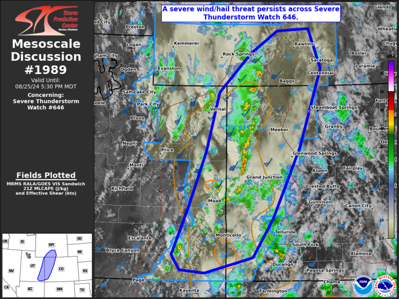
   Areas affected...portions of eastern Utah into southern Wyoming and
   western Colorado

   Concerning...Severe Thunderstorm Watch 646...

   Valid 252157Z - 252330Z

   The severe weather threat for Severe Thunderstorm Watch 646
   continues.

   SUMMARY...The severe threat continues across Severe Thunderstorm
   Watch 646. Severe hail and wind remain the main threats with the
   stronger storms.

   DISCUSSION...Clusters of supercells and multicells have organized
   across eastern portions of the Great Basin this afternoon amid
   seasonally impressive mid-level flow and associated deep-layer shear
   (bulk effective shear values exceeding 60 kts in spots). Given over
   1500 J/kg MLCAPE in place (with well over 100 J/kg in the 0-3 km
   layer alone), organized storm modes, including supercells, should
   persist through the afternoon. Thunderstorms, and an associated
   severe hail/wind threat, should continue to progress eastward across
   Severe Thunderstorm Watch 646 in tandem with the eastward-tracking
   500 mb trough.

   ..Squitieri.. 08/25/2024

   ...Please see www.spc.noaa.gov for graphic product...

   ATTN...WFO...BOU...CYS...RIW...GJT...SLC...

   LAT...LON   37470834 37160959 37221024 37531045 38511002 39650958
               40860923 41670840 42130768 42170684 41350651 39740709
               38280781 37470834
|
|
Top/All Mesoscale Discussions/Forecast Products/Home
|
|


