|
| Mesoscale Discussion 1978 |
|
< Previous MD Next MD >
|
|
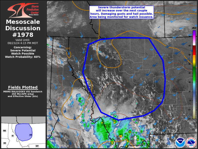
   Mesoscale Discussion 1978
   NWS Storm Prediction Center Norman OK
   0313 PM CDT Fri Aug 23 2024

   Areas affected...portions of western and central Montana

   Concerning...Severe potential...Watch possible

   Valid 232013Z - 232215Z

   Probability of Watch Issuance...60 percent

   SUMMARY...Thunderstorms will increase in coverage and intensity over
   the next few hours across western and central Montana. Isolated
   damaging gust of 55-70 mph are possible, along with a few instances
   of hail to near one inch diameter.

   DISCUSSION...Gradual destabilization is occurring over the MCD area
   as temperatures have warmed into the 80s F this afternoon.
   Boundary-layer moisture will remain meager, but steep midlevel lapse
   rates/cool temperatures aloft will support MLCAPE increasing to
   around 500-1000 J/kg through early evening. Deepening cumulus is
   noted over the mountains and thunderstorms are expected to increase
   in coverage over the next couple of hours as stronger ascent
   overspreads the region.

   Favorable vertical shear will support organized updrafts/clusters,
   while dry low-levels and very steep low-level lapse rates support
   strong/severe gusts. Elongated/straight hodographs in conjunction
   with favorable midlevel instability/shear will also support isolated
   marginally severe hail with more intense/longer-lived updrafts.
   While some MLCIN remains over the region, additional heating and
   increasing ascent should gradually erode inhibition, but overall
   poor vertical moisture profiles will limit instability.
   Nevertheless, a severe thunderstorm watch may become necessary,
   especially if convection across southwest MT/eastern ID sufficiently
   organizes into forward propagating clusters with time as this
   activity shifts north/northeast.

   ..Leitman/Guyer.. 08/23/2024

   ...Please see www.spc.noaa.gov for graphic product...

   ATTN...WFO...BYZ...TFX...MSO...

   LAT...LON   47561510 48721479 48931407 49031285 48991101 48061016
               47261004 46551016 46311028 45981076 45781140 45591292
               45911393 46921475 47561510
|
|
Top/All Mesoscale Discussions/Forecast Products/Home
|
|


 @NWSSPC