|
| Mesoscale Discussion 1952 |
|
< Previous MD Next MD >
|

|
   Mesoscale Discussion 1952
   NWS Storm Prediction Center Norman OK
   0731 PM CDT Sun Aug 18 2024

   Areas affected...Southern Alabama into southern Georgia and far
   northern Florida Panhandle

   Concerning...Severe Thunderstorm Watch 638...

   Valid 190031Z - 190200Z

   The severe weather threat for Severe Thunderstorm Watch 638
   continues.

   SUMMARY...Wind damage will remain possible for the next 1-3 hours
   before a gradual weakening trend will become increasingly likely.

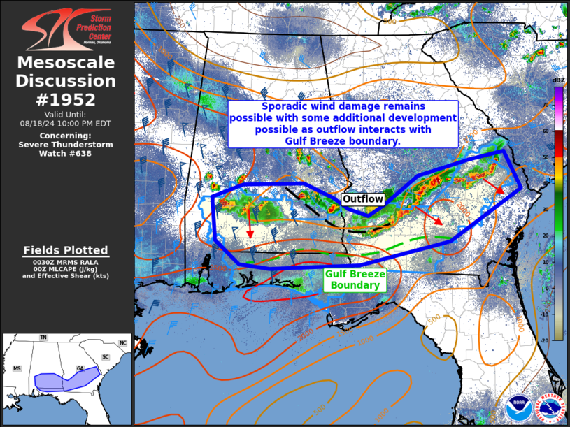
   DISCUSSION...Modestly organized clusters/linear segments continue
   across southern portions of Alabama and Georgia. Within the last
   half hour, 37 knots was the highest measured gust at Warner Robbins
   along with a few wind damage reports. The strongest effective shear
   remains across the western portions of this activity, though linear
   organization has been greater farther east. The expectation is for
   wind damage to remain possible over the next 1-3 hours before
   diurnal stabilization weakens activity. Regional radar imagery did
   show a fine line feature moving north. This is likely the Gulf
   Breeze front. Some possible brief intensification/redevelopment is
   possible as outflow/storms interact with this front.

   ..Wendt.. 08/19/2024

   ...Please see www.spc.noaa.gov for graphic product...

   ATTN...WFO...CHS...JAX...FFC...TAE...BMX...MOB...

   LAT...LON   31988788 32238723 32278592 32008527 31818498 31688454
               31888421 32418348 32688237 32838161 32148126 31198280
               30778472 30708662 30768727 31208780 31988788
|
|
Top/All Mesoscale Discussions/Forecast Products/Home
|
|


