|
| Mesoscale Discussion 1909 |
|
< Previous MD Next MD >
|

|
   Mesoscale Discussion 1909
   NWS Storm Prediction Center Norman OK
   0326 PM CDT Thu Aug 15 2024

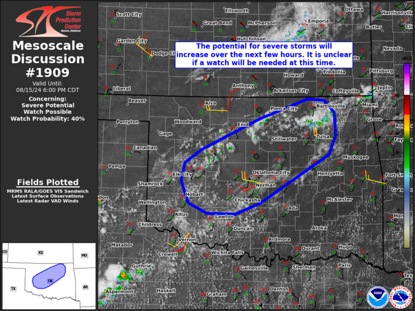
   Areas affected...Portions of northern and central Oklahoma

   Concerning...Severe potential...Watch possible

   Valid 152026Z - 152300Z

   Probability of Watch Issuance...40 percent

   SUMMARY...Portions of northern and central Oklahoma are being
   monitored for severe thunderstorm potential this afternoon.
   Thunderstorms will be capable of producing damaging winds and
   isolated large hail. It is unclear if a watch is needed at this
   time.

   DISCUSSION...Latest visible satellite and radar data indicate
   agitated cumulus (some possibly rooted above the boundary layer) and
   isolated convective initiation across northern and central OK --
   generally focused along a pre-frontal surface trough. During the
   next few hours, several high-based thunderstorms should evolve and
   gradually intensify, given continued boundary-layer
   heating/steepening lapse rates and rich boundary-layer moisture.
   While around 20-25 kt of effective shear could limit storm
   organization until a substantial cold pool can develop, sporadic
   strong to severe downbursts and marginally severe hail could
   accompany the more robust cores in the near term.

   With time, increasing storm coverage should promote a greater risk
   of severe gusts, especially with any convective clustering that
   occurs. It is unclear if a watch will be needed in the near term,
   and convective trends are being monitored.

   ..Weinman/Thompson.. 08/15/2024

   ...Please see www.spc.noaa.gov for graphic product...

   ATTN...WFO...TSA...OUN...

   LAT...LON   35989872 36589733 36959619 36929580 36699554 36249553
               35889568 34949733 34729792 34739858 34949903 35369919
               35719912 35989872
|
|
Top/All Mesoscale Discussions/Forecast Products/Home
|
|


