|
| Mesoscale Discussion 1865 |
|
< Previous MD Next MD >
|

|
   Mesoscale Discussion 1865
   NWS Storm Prediction Center Norman OK
   0759 AM CDT Thu Aug 08 2024

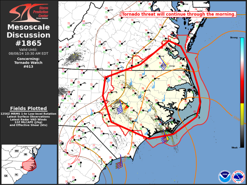
   Areas affected...Eastern NC into southeast VA

   Concerning...Tornado Watch 613...

   Valid 081259Z - 081430Z

   The severe weather threat for Tornado Watch 613 continues.

   SUMMARY...The tornado threat will continue through the morning, and
   gradually spread northward with time.

   DISCUSSION...Occasional small supercells and possible tornadoes
   continue to be noted within the northeast quadrant of Tropical Storm
   Debby, which is forecast by NHC to gradually accelerate northward
   through the day. The northeast quadrant will continue to be the
   favored area for tornado potential, due to having the most favorable
   wind profiles (with regional VWPs and the 12Z MHX sounding depicting
   0-1 km SRH of 200-400 m2/s2), as well as somewhat stronger
   instability, along the eastern periphery of the larger precipitation
   shield. This area of favorable buoyancy/shear overlap will gradually
   spread northward through the day, with some tornado potential
   eventually moving into parts of northeast NC and southeast VA, where
   very moist and relatively warm conditions are already in place.

   ..Dean.. 08/08/2024

   ...Please see www.spc.noaa.gov for graphic product...

   ATTN...WFO...AKQ...MHX...RAH...ILM...

   LAT...LON   34467739 34977877 35767911 36327903 36737772 37457663
               37277618 36557572 35997554 35537549 35127563 34617649
               34467739
|
|
Top/All Mesoscale Discussions/Forecast Products/Home
|
|


