|
| Mesoscale Discussion 1846 |
|
< Previous MD Next MD >
|

|
   Mesoscale Discussion 1846
   NWS Storm Prediction Center Norman OK
   0258 PM CDT Tue Aug 06 2024

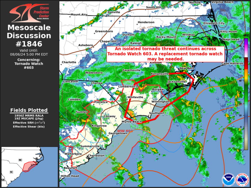
   Areas affected...portions of eastern North Carolina

   Concerning...Tornado Watch 603...

   Valid 061958Z - 062100Z

   CORRECTED FOR WORDING

   The severe weather threat for Tornado Watch 603 continues.

   SUMMARY...An isolated tornado threat should continue through the
   afternoon across Tornado Watch 603. A replacement tornado watch may
   be needed.

   DISCUSSION...Occasionally transient supercells have produced brief
   bouts of appreciable low-level rotation over the past few hours
   along the NC coastline. However, no tornado reports have been
   received, or indicated via a TDS on radar. Given widespread cloud
   cover and precipitation, the inland airmass has struggled to
   destabilize. While regional VADs show curved low-level hodographs
   and potentially greater than 200 m2/s2 0-1 and 0-3 km SRH, the
   limited buoyancy may temper the tornado threat to a degree.
   Nonetheless, the stronger low-level shear will overspread existent
   buoyancy for several hours this afternoon, affording the opportunity
   for at least a couple of brief tornadoes to occur. As such, a
   replacement watch may be needed in the next hour, as Tornado Watch
   603 expires.

   ..Squitieri/Hart.. 08/06/2024

   ...Please see www.spc.noaa.gov for graphic product...

   ATTN...WFO...MHX...RAH...ILM...

   LAT...LON   33867876 34757845 34997778 35047682 34857656 34537674
               34127748 33827781 33697832 33867876
|
|
Top/All Mesoscale Discussions/Forecast Products/Home
|
|


