|
| Mesoscale Discussion 1836 |
|
< Previous MD Next MD >
|

|
   Mesoscale Discussion 1836
   NWS Storm Prediction Center Norman OK
   1125 PM CDT Mon Aug 05 2024

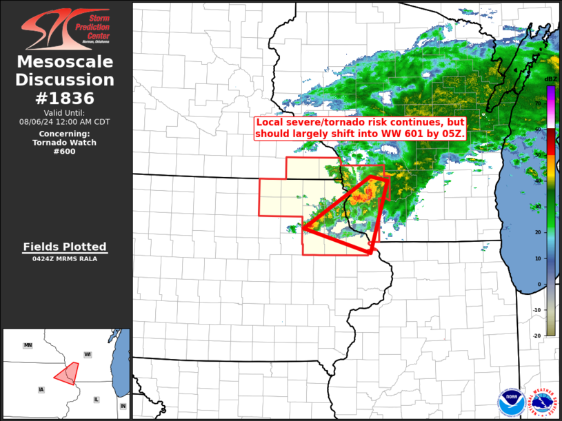
   Areas affected...northeastern Iowa/southwestern Wisconsin

   Concerning...Tornado Watch 600...

   Valid 060425Z - 060500Z

   The severe weather threat for Tornado Watch 600 continues.

   SUMMARY...Tornado risk across the remainder of WW 600 will continue
   to diminish as storms move eastward/out of the watch.  New WW will
   not be required.

   DISCUSSION...Latest radar loop shows the strongest storms within the
   ongoing cluster now moving across southwestern Wisconsin/into WW
   601.  While a favorable airmass persists near the Mississippi River
   Valley, storms across northeastern Iowa have remained generally
   sub-severe, and expect them to largely remain so.  As such, it
   appears reasonable to allow WW 600 to expire as scheduled at 06/05Z.

   ..Goss.. 08/06/2024

   ...Please see www.spc.noaa.gov for graphic product...

   ATTN...WFO...MKX...DVN...ARX...

   LAT...LON   42729205 43549060 43479024 42339061 42729205
|
|
Top/All Mesoscale Discussions/Forecast Products/Home
|
|


