|
| Mesoscale Discussion 1808 |
|
< Previous MD Next MD >
|

|
   Mesoscale Discussion 1808
   NWS Storm Prediction Center Norman OK
   0435 PM CDT Sat Aug 03 2024

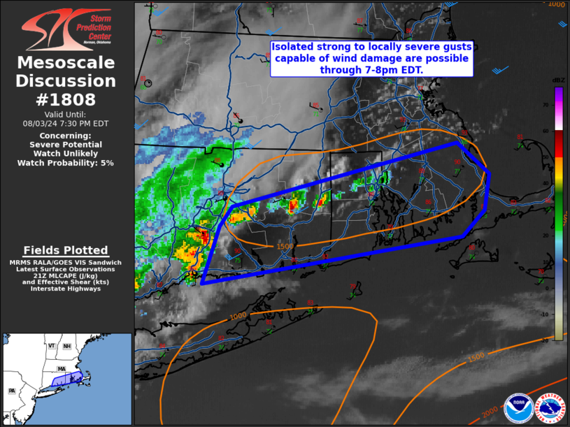
   Areas affected...eastern CT...RI...southeast MA

   Concerning...Severe potential...Watch unlikely

   Valid 032135Z - 032330Z

   Probability of Watch Issuance...5 percent

   SUMMARY...Isolated strong to locally severe gusts (50-60 mph)
   capable of pockets of wind damage are possible through 8pm EDT.  The
   isolated coverage of the expected wind threat will preclude a severe
   thunderstorm watch issuance.

   DISCUSSION...A warm/moist boundary layer is evident in late
   afternoon surface observations (temperatures in the upper 80s to 90
   with mid 70 deg F dewpoints) over southern New England ahead of a
   small strong-severe thunderstorm cluster in southwest parts of CT.
   This activity will likely move east-northeast over the next few
   hours.  Short-term model forecast soundings show upwards of 2000+
   J/kg MLCAPE with PW around 1.9 inches.  A couple of the stronger
   thunderstorm cores may yield a localized damaging wind risk into the
   evening before this activity weakens.

   ..Smith.. 08/03/2024

   ...Please see www.spc.noaa.gov for graphic product...

   ATTN...WFO...BOX...OKX...

   LAT...LON   41567268 41677258 42067077 41877051 41657055 41507073
               41207283 41567268
|
|
Top/All Mesoscale Discussions/Forecast Products/Home
|
|


