|
| Mesoscale Discussion 1792 |
|
< Previous MD Next MD >
|

|
   Mesoscale Discussion 1792
   NWS Storm Prediction Center Norman OK
   0801 PM CDT Thu Aug 01 2024

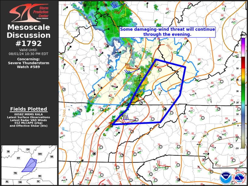
   Areas affected...Eastern KY/TN into western VA and extreme southwest
   WV

   Concerning...Severe Thunderstorm Watch 589...

   Valid 020101Z - 020230Z

   The severe weather threat for Severe Thunderstorm Watch 589
   continues.

   SUMMARY...Some threat for damaging wind will continue eastward
   through the evening.

   DISCUSSION...While the northern portion of the long-lived MCS moving
   across KY has weakened, some intensification has been noted along
   the southern portion of the gust front, as the attendant cold pool
   has overtaken a preceding band of convection that developed from
   northeast TN into southeast KY. This portion of the MCS produced a
   49 kt gust near London, KY, and will pose the greatest relative
   threat for damaging wind. A gradual weakening trend is expected
   later tonight, as MLCINH begins to increase and downstream buoyancy
   decreases, but in the short term, warm/moist conditions and MLCAPE
   of greater than 1500 J/kg will support at least isolated
   damaging-wind potential through much of the evening.

   ..Dean.. 08/02/2024

   ...Please see www.spc.noaa.gov for graphic product...

   ATTN...WFO...RNK...RLX...MRX...JKL...

   LAT...LON   36458371 37038335 37868270 37648167 36858188 36108255
               36048420 36268395 36458371
|
|
Top/All Mesoscale Discussions/Forecast Products/Home
|
|


