Storm Prediction Center Day 1 Fire Weather Outlook
Created: Mon Mar 31 15:59:03 UTC 2025 (
![]() |
| ![]() )
)
| |||||||||
Click for Day 1 FireWX Areal Outline Product
ZCZC SPCFWDDY1 ALL
FNUS21 KWNS 311557
Day 1 Fire Weather Outlook
NWS Storm Prediction Center Norman OK
1057 AM CDT Mon Mar 31 2025
Valid 311700Z - 011200Z
The previous forecast (see below) remains on track, with only minor
changes made to the ongoing Elevated highlights to account for the
latest guidance consensus.
..Squitieri.. 03/31/2025
.PREV DISCUSSION... /ISSUED 0159 AM CDT Mon Mar 31 2025/
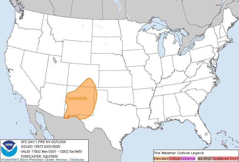
...Synopsis...
Midlevel westerly flow will gradually strengthen across the
southern/central Rockies -- well ahead of an amplifying large-scale
trough over the West. This will promote lee troughing over the High
Plains, with a modest pressure gradient across southeast CO and much
of NM. As a result, breezy west-southwesterly surface winds will
overlap 10-15 percent RH, favoring elevated to locally critical
fire-weather conditions.
...Please see www.spc.noaa.gov/fire for graphic product...