|
Welcome to the SVRGIS page for the SPC.
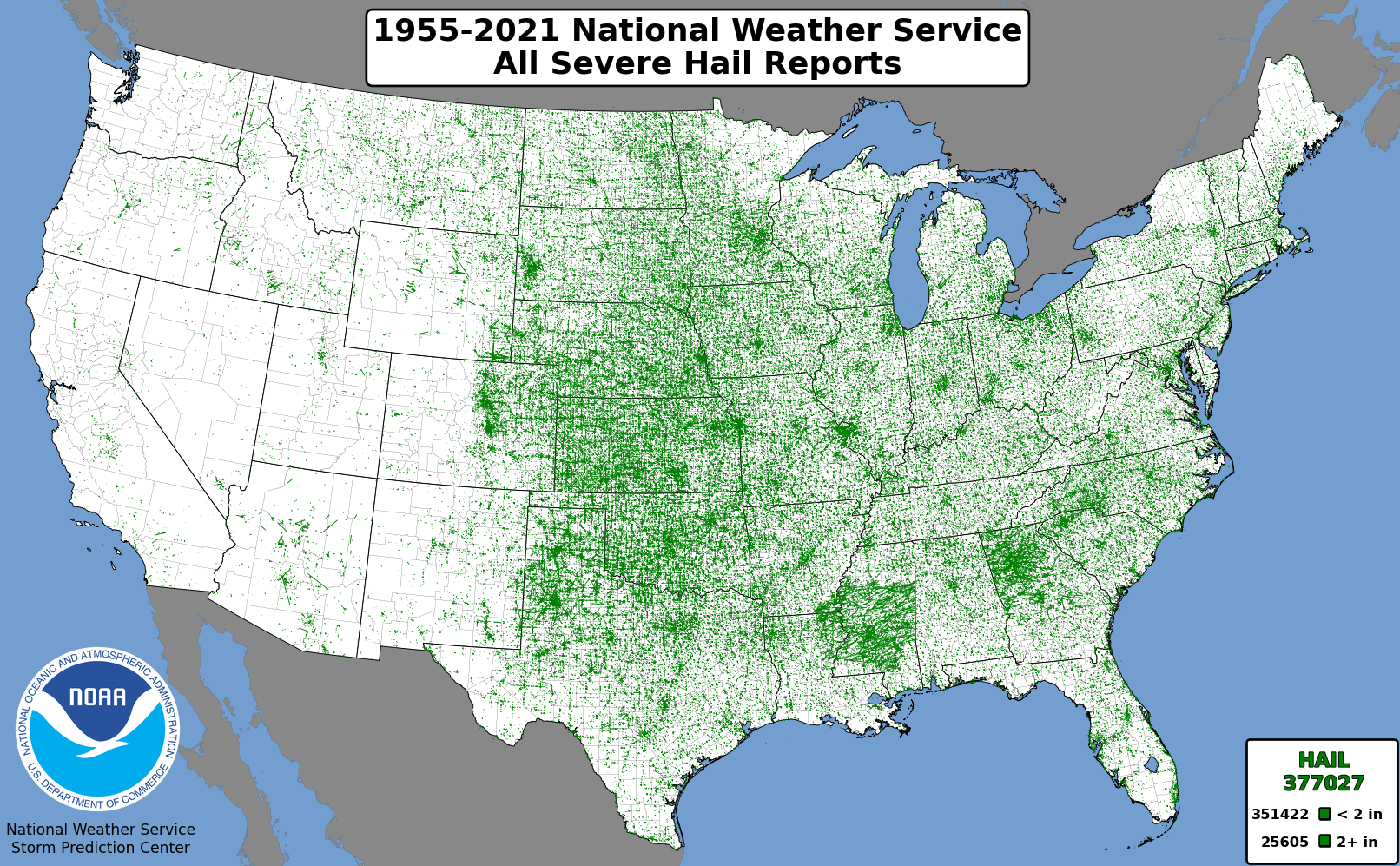
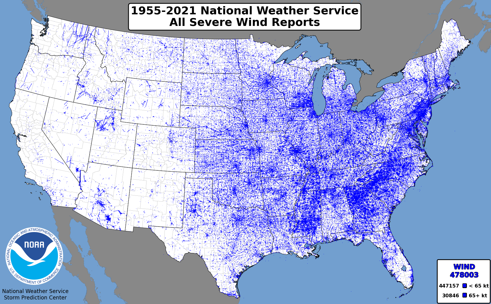
This page has the United States severe report database (tornadoes 1950-2023, hail/wind 1955-2023),
converted into shapefile (.shp) file format.
The data can be viewed in graphical, tabular, and statistical formats depending on end-user programs.
The NOAA/NWS Geodata page, has links that are directed to free,
easy-to-use GIS viewing programs.
The data originate from the comma separated value (.csv) files available at:
http://www.spc.noaa.gov/wcm/#data
The column headings are the same as those described in this document:
http://www.spc.noaa.gov/wcm/data/SPC_severe_database_description.pdf
Location Codes for Storm data here.
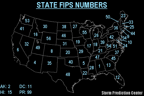
Map of State FIPS Numbers here.
Text list of County FIPS Numbers here.
Previously, the data were prepared in a USA Contiguous Lambert Conformal Conic projection with North American Datum 1983.
However, after numerous requests, beginning in 2018, the data are now provided latitude and longitude coordinates.
The data are contained in zip files and can be quite large, up to around 55MB (i.e. Cities.zip).
There are two kinds of zip files for each severe thunderstorm hazard: paths and initial points.
In the paths file, all tornadoes are converted into a LineString, regardless of whether or not end point coordinates were provided.
To do this, if end point coordinates were not provided, the end point coordinates were set to be +0.0001 degrees offset from the starting point.
This was done to be able to include all reports into a single file.
(Shpfiles only allow a single geometry type.)
The initial points file only includes the starting points of all events.
Lastly, please see the new changelog for the latest information regarding changes to the data that goes into creating these GIS files.
If you have comments regarding this information,
contact Patrick Marsh and Matthew Elliott
of the Storm Prediction Center.
CHANGE LOG: Read Here
| 


 @NWSSPC
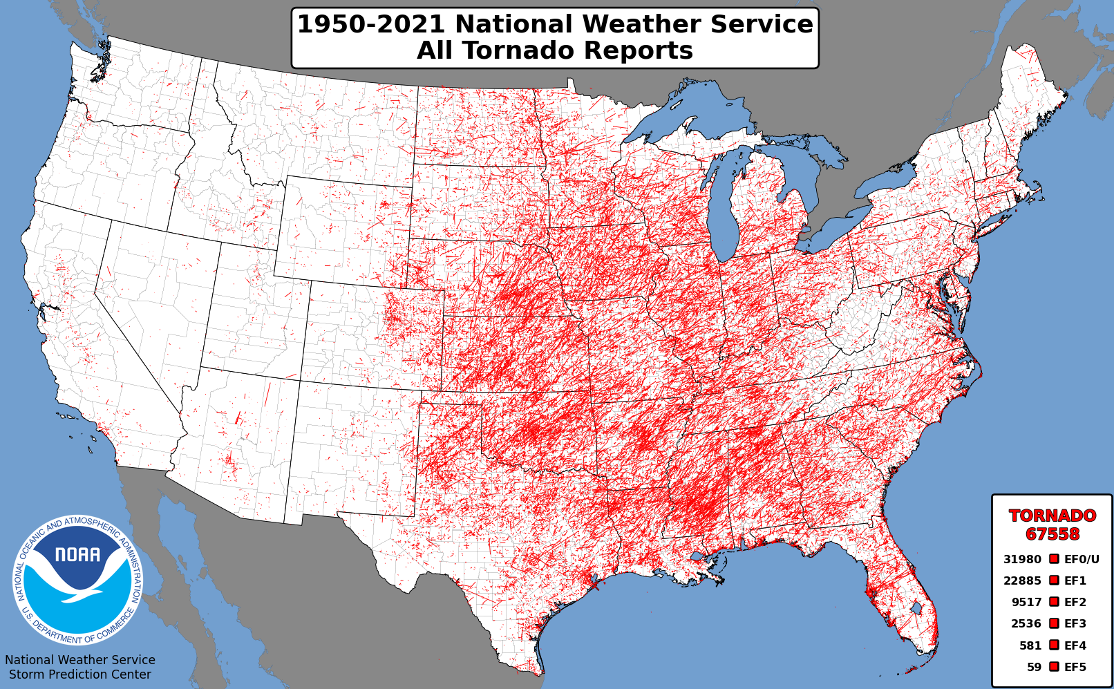