Kansas City, MO...Overland Park, KS...Rockford, IL...Kansas City, KS...Sioux Falls, SD...
SPC AC 150721
Day 3 Convective Outlook
NWS Storm Prediction Center Norman OK
0221 AM CDT Tue Apr 15 2025
Valid 171200Z - 181200Z
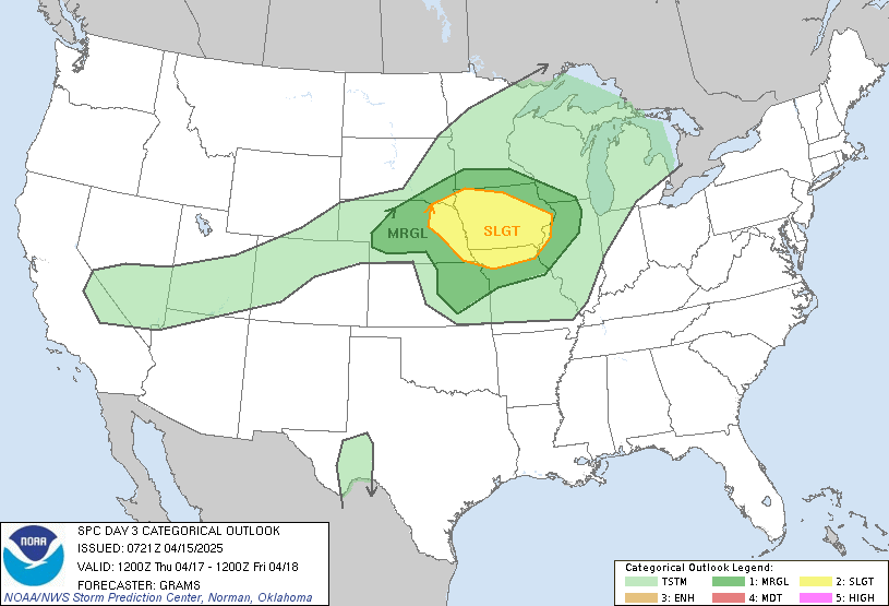
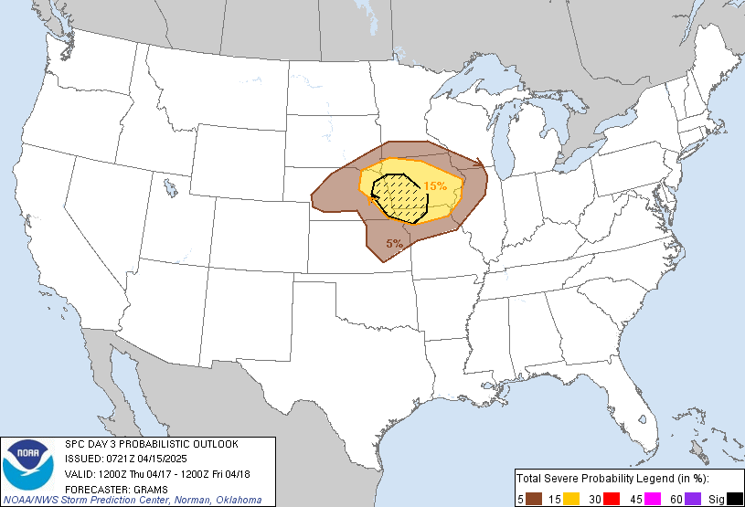
...THERE IS A SLIGHT RISK OF SEVERE THUNDERSTORMS IN IA/NORTHERN
MO/EASTERN NE...
...SUMMARY...
Scattered severe thunderstorms, with a primary threat of large hail,
are possible on Thursday evening/night, centered on eastern
Nebraska, northern Missouri, and Iowa.
...Synopsis...
A longwave trough, consisting of multiple embedded shortwave
impulses, will become established from the southern Prairie
Provinces across the West to off the Baja CA coast. Peak surface
cyclone amplitude is expected over western KS on Thursday afternoon,
with a surface trough/baroclinic zone extending north-northeast into
MN. A dryline will arc across eastern KS into the southern Great
Plains. The cyclone will fill as it tracks east-northeast along the
baroclinic zone towards the MO/IA border area Thursday night.
...IA/MO/NE...
Along the leading edge of a stout EML and effective 700-mb warm
front, isolated to scattered elevated convection should be ongoing
at 12Z Thursday across parts of the Lower MO Valley. This activity
may persist eastward through the morning and pose a threat for
isolated severe hail. Neutral mid-level height change is anticipated
in its wake, likely confining early evening surface-based storm
potential to immediately downstream of the triple-point region in
the KS/NE/MO/IA border area. While the spatial extent of MLCIN away
from the dryline is a concern, another day of modifying moisture
return northward from the western Gulf should yield a confined plume
of upper 50s surface dew points and moderate buoyancy. A veering
wind profile with height will foster strong deep-layer shear and
supercell potential.
As the low-level jet becomes rather strong across OK/KS/MO, greater
convective coverage is anticipated Thursday night. Elevated storms
producing large hail should be the primary hazard from the
post-frontal environment in central/eastern NE to across the Mid-MS
Valley by early morning Friday.
..Grams.. 04/15/2025
CLICK TO GET WUUS03 PTSDY3 PRODUCT
NOTE: THE NEXT DAY 3 OUTLOOK IS SCHEDULED BY 1930Z