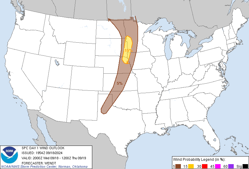
Probability of damaging thunderstorm winds or wind gusts of 50 knots or higher within 25 miles of a point. Hatched Area: 10% of greater probability of wind gusts 65 knots or greater within 25 miles of a point.
Probability of hail 1" or larger within 25 miles of a point. Hatched Area: 10% or greater probability of hail 2" or larger within 25 miles of a point.
Day 1 Hail Risk
Area (sq. mi.)
Area Pop.
Some Larger Population Centers in Risk Area
No Risk Areas Forecast
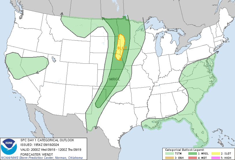
SPC AC 301958
Day 1 Convective Outlook
NWS Storm Prediction Center Norman OK
0158 PM CST Thu Jan 30 2025
Valid 302000Z - 311200Z
...THERE IS A SLIGHT RISK OF SEVERE THUNDERSTORMS THIS AFTERNOON AND
EVENING ACROSS PARTS OF LOUISIANA...SOUTHWEST MISSISSIPPI...AND FAR
SOUTHEAST ARKANSAS...
...SUMMARY...
Strong/isolated severe storms will be possible today into tonight
from eastern portions of Texas eastward across the Lower Mississippi
Valley.
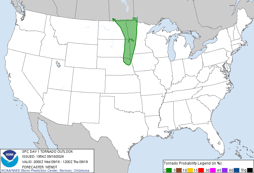
...20Z Update...
The only change with this update was a minor northward expansion of
the Slight risk into southeast Arkansas. Here, the warm front has
progressed northward, with surface temperatures now in the lower 70s
amid increasing boundary-layer moisture. This suggests surface-based
storms will be possible amid the high helicity air already in place
-- with an associated risk of a tornado and/or damaging gusts. For
additional details, see the previous discussion below.
..Weinman.. 01/30/2025
.PREV DISCUSSION... /ISSUED 1008 AM CST Thu Jan 30 2025/
...LA/MS...
Morning water vapor imagery shows a deep upper low over southeast
CO, with a band of strong southwesterly flow aloft extending across
central TX. A cold front is sweeping eastward across east TX into a
moist but only marginally unstable air mass across the ArkLaTex
region. The result is likely to be a continued risk of showers and
thunderstorms along/behind the front.
Forecast soundings throughout the pre-frontal region show strong
low-level and deep-layer shear, providing a favorable conditional
environment for organized convection and updraft rotation. The
primary concern is the weak forcing in the warm sector, and the weak
thermodynamic profiles. These factors suggest storms along the
immediate front may become strong/severe, but it is uncertain how
long the storms can remain surface-based before being undercut by
the front. Nevertheless, the strongest cells could produce damaging
wind gusts or a tornado or two through the afternoon and evening.
NOTE: THE NEXT DAY 1 OUTLOOK IS SCHEDULED BY 0100Z