
Day 3 Probabilistic Fire Weather Outlooks:
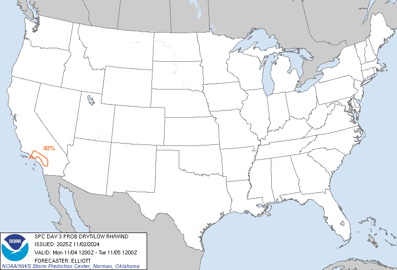
Probability of dry thunderstorms with dry fuels within 12 miles of a point denoted by scalloped lines for
- Critical Area - 40% (blue)
- Marginal Area - 10% (brown)
Probability of strong winds, low RH, and warm temperatures concurrent for at least 3 hours with dry fuels within 12 miles of a point denoted by solid lines for
- Critical Area - 70% (red)
- Marginal Area - 40% (orange)

Day 4 Probabilistic Fire Weather Outlooks:
Probability of dry thunderstorms with dry fuels within 12 miles of a point denoted by scalloped lines for
- Critical Area - 40% (blue)
- Marginal Area - 10% (brown)
Probability of strong winds, low RH, and warm temperatures concurrent for at least 3 hours with dry fuels within 12 miles of a point denoted by solid lines for
- Critical Area - 70% (red)
- Marginal Area - 40% (orange)

Day 5 Probabilistic Fire Weather Outlooks:
Probability of dry thunderstorms with dry fuels within 12 miles of a point denoted by scalloped lines for
- Critical Area - 40% (blue)
- Marginal Area - 10% (brown)
Probability of strong winds, low RH, and warm temperatures concurrent for at least 3 hours with dry fuels within 12 miles of a point denoted by solid lines for
- Critical Area - 70% (red)
- Marginal Area - 40% (orange)

Day 6 Probabilistic Fire Weather Outlooks:
Probability of dry thunderstorms with dry fuels within 12 miles of a point denoted by scalloped lines for
- Critical Area - 40% (blue)
- Marginal Area - 10% (brown)
Probability of strong winds, low RH, and warm temperatures concurrent for at least 3 hours with dry fuels within 12 miles of a point denoted by solid lines for
- Critical Area - 70% (red)
- Marginal Area - 40% (orange)

Day 7 Probabilistic Fire Weather Outlooks:
Probability of dry thunderstorms with dry fuels within 12 miles of a point denoted by scalloped lines for
- Critical Area - 40% (blue)
- Marginal Area - 10% (brown)
Probability of strong winds, low RH, and warm temperatures concurrent for at least 3 hours with dry fuels within 12 miles of a point denoted by solid lines for
- Critical Area - 70% (red)
- Marginal Area - 40% (orange)

Day 8 Probabilistic Fire Weather Outlooks:
Probability of dry thunderstorms with dry fuels within 12 miles of a point denoted by scalloped lines for
- Critical Area - 40% (blue)
- Marginal Area - 10% (brown)
Probability of strong winds, low RH, and warm temperatures concurrent for at least 3 hours with dry fuels within 12 miles of a point denoted by solid lines for
- Critical Area - 70% (red)
- Marginal Area - 40% (orange)
| ||||||||
| D3 | Mon, Nov 04, 2024 - Tue, Nov 05, 2024 | D6 | Thu, Nov 07, 2024 - Fri, Nov 08, 2024 |
| D4 | Tue, Nov 05, 2024 - Wed, Nov 06, 2024 | D7 | Fri, Nov 08, 2024 - Sat, Nov 09, 2024 |
| D5 | Wed, Nov 06, 2024 - Thu, Nov 07, 2024 | D8 | Sat, Nov 09, 2024 - Sun, Nov 10, 2024 |
| (All days are valid from 12 UTC - 12 UTC) | |||
   ZCZC SPCFWDD38 ALL
   FNUS28 KWNS 022025

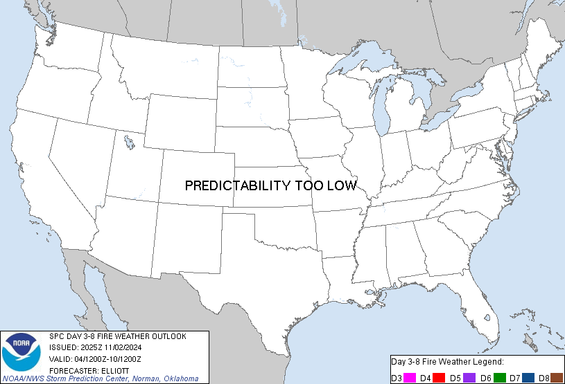
   Day 3-8 Fire Weather Outlook
   NWS Storm Prediction Center Norman OK
   0325 PM CDT Sat Nov 02 2024

   Valid 041200Z - 101200Z

   A mid-level trough is forecast to move from the Southwest into the
   Great Plains Day 3/Monday, before ejecting into the Mississippi
   Valley by mid-week. As this trough shifts east, another strong
   mid-level trough is forecast to amplify while gradually shifting
   southward across the western U.S. Day 3/Monday through at least Day
   6/Thursday. As this occurs, high pressure is forecast to build and
   strengthen across the Interior West, which will promote fire weather
   concerns across portions of California.

   Day 3/Monday: Southern California
   Elevated to at least locally critical fire weather conditions are
   forecast to be ongoing Day 3/Monday morning across the wind-prone
   mountain and valley areas of Southern California with poor overnight
   RH recoveries and strong/gusty north to northeast winds. Fire
   weather conditions are forecast to continue into the afternoon
   before the pressure gradient relaxes and wind speeds lower.

   Day 5/Wednesday - Day 6/Thursday: Southern/Northern California:
   Potentially stronger, more widespread, and longer duration
   fire-weather conditions are possible by midweek across portions of
   California associated with the aforementioned secondary mid-level
   trough. On Day 5/Wednesday, dry and breezy conditions may occur
   across portions of northern California, though continued
   uncertainties regarding minimum RH reductions and fuel receptiveness
   after recent rainfall (exceeding 0.5" in some areas) precludes
   introducing Critical probabilities at this time.

   Confidence in Critical fire weather conditions is greater further
   south across portions of Southern California, where strong/gusty
   winds are expected atop fuels that remain receptive from
   little-to-no recent rainfall. For this outlook cycle, 40%
   probabilities for Critical fire weather conditions were maintained
   on Day 5/Wednesday and 40% probabilities for Critical were
   introduced Day 6/Thursday across the wind-prone mountains and valley
   areas of Southern California. Upgrades and refinements to the
   outlook area are probable over the next few days as guidance
   continues to come into better agreement.

   ..Elliott.. 11/02/2024

   ...Please see www.spc.noaa.gov/fire for graphic product...

   $$

   CLICK TO GET FNUS38 KWNS PFWF38 FIRE WEATHER OUTLOOK DAY 3-8 AREAL OUTLINE PRODUCT